VOLUME
SURVEYS
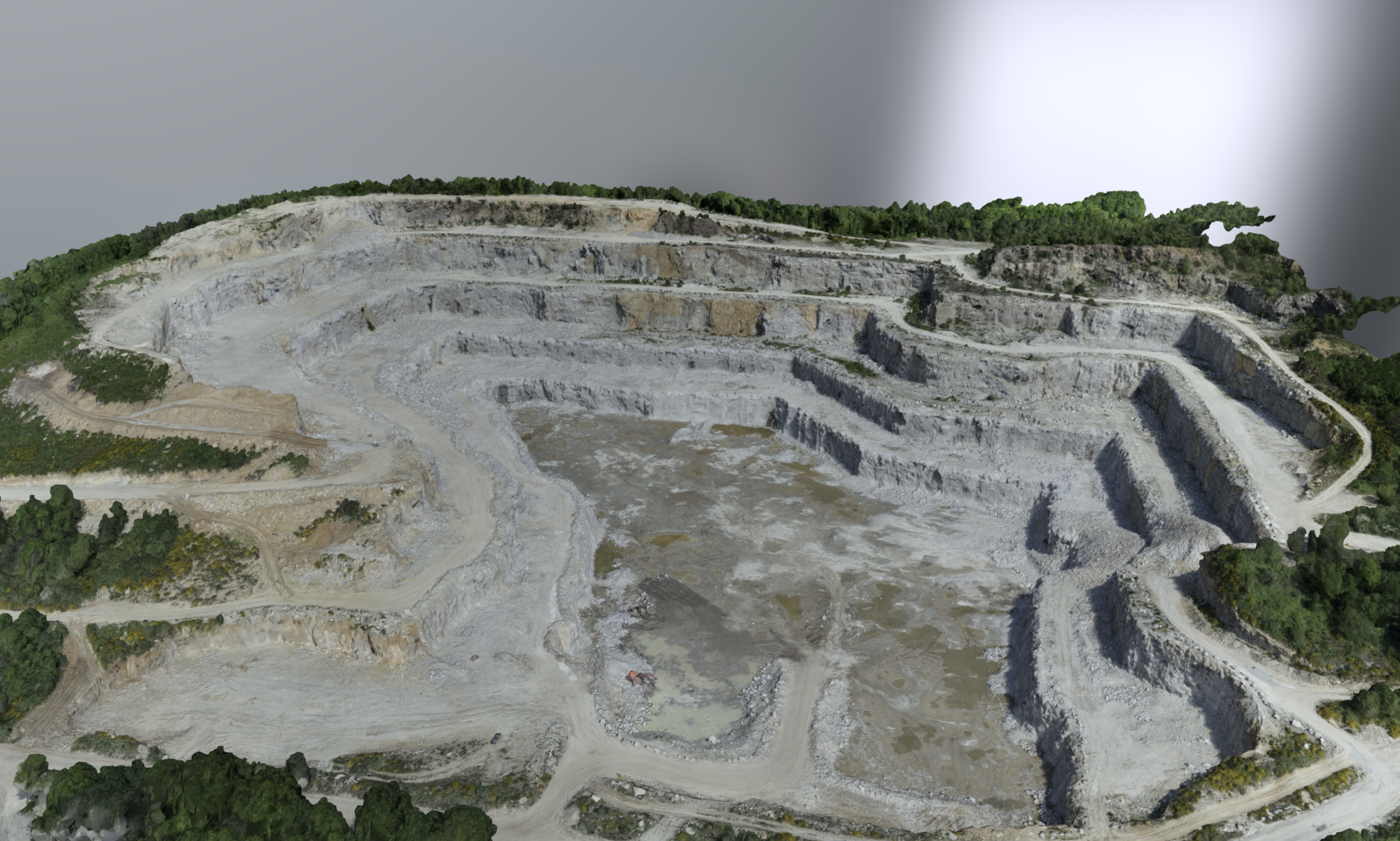


VOLUME SURVEYS
3D laser scanning enables accurate volumetric surveys to be conducted in a fraction of the time required by traditional methods, drastically reducing both costs and operational downtime. By capturing millions of data points per second, 3D laser scanners generate a dense point cloud that can be converted into an accurate 3D mesh model. From this 3D mesh model, volumes can be calculated with unparalleled precision, minimizing errors and improving overall reliability. Common applications include volume calibrations of above-ground and underground storage tanks, stockpiles, terrain, and the determination and verification of equipment volumes (such as ballast and fuel tanks). The combination of speed, accuracy, and versatility makes 3D laser scanning an indispensable tool for projects of any size requiring precise volumetric measurements.
EQUIPMENT USED
Terrestrial 3D Laser Scanner: Leica RTC360 (3D Accuracy: 1.9 mm)
Terrestrial 3D Laser scanner: Faro Focus S 150 (3D Accuracy: 2 mm)
Terrestrial 3D Laser Scanner: Leica BLK360 (3D Accuracy: 4 mm)
Total Station: Leica FlexLine TS10 1” R1000 (Accuracy: 1 mm, Angular Accuracy: 1 s)
RTK GNSS: Leica GS18 T GNSS RTK Rover (Accuracy: 8 mm)
Sphere Targets
APPLICATIONS
Volume Calibration of Above-Ground & Underground Storage Tanks
Volume Survey of Stockpiles & Terrain
Determination & Verification of Equipment Volume (Such as Ballast and Fuel Tanks)
Georeferenced Volume Surveys
APPLICATIONS
-
![INDUSTRY & ENERGY]()
INDUSTRY & ENERGY
Elevate industry operations with 3D laser scanning, which rapidly collects spatial 3D data and minimizes on-site disruptions.
-
![MINING & TUNNELING]()
MINING & TUNNELING
Optimize safety and efficiency in mines and tunnels with 3D laser scanning.
-
![CIVIL ENGINEERING & ARCHITECTURE]()
CIVIL ENGINEERING & ARCHITECTURE
Advance civil and architectural projects with faster, more accurate surveying through 3D laser scanning.
-
![MARINE & OFFSHORE]()
MARINE & OFFSHORE
Transform offshore and maritime operations with advanced 3D laser scanning solutions.