ENGINEERING
& ENERGY
TUNNELING
& ARCHITECTURE
OFFSHORE


Where We Excel
Industries We 3D Laser Scan & Measure Using Laser Trackers
REVERSE
ENGINEERING
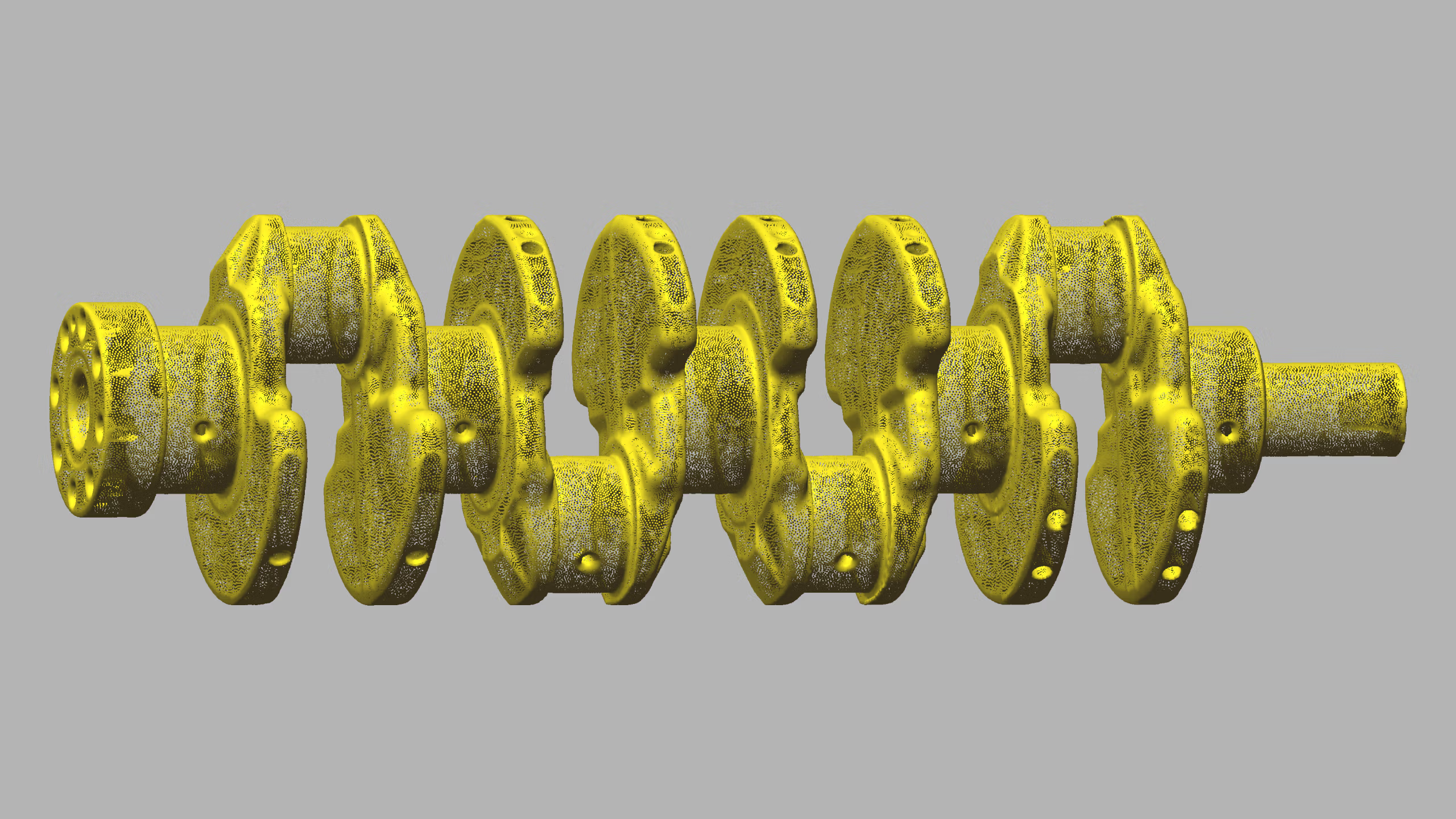
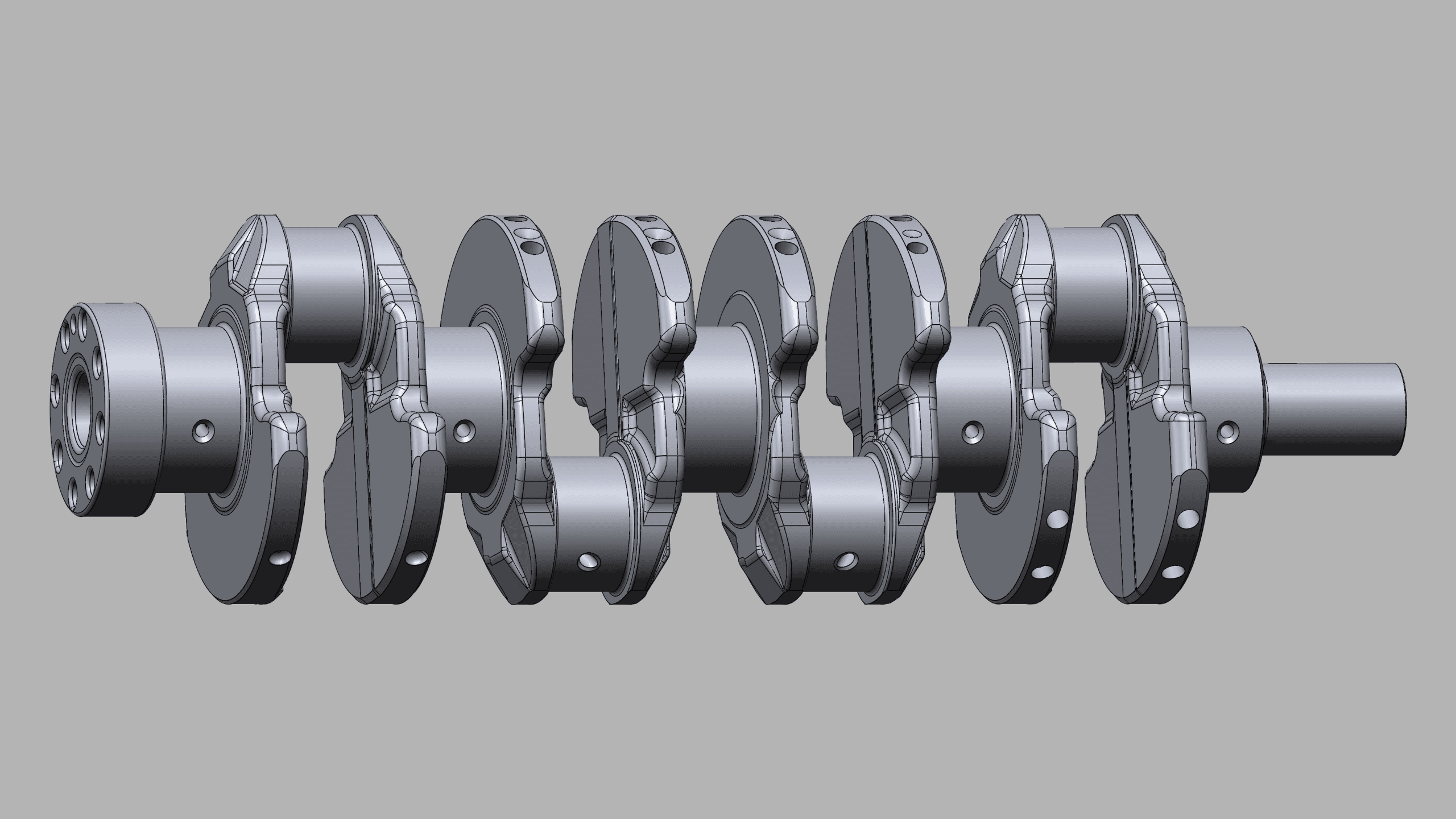
Rebuild complex components as accurate as-built 2D & 3D CAD models from 3D laser scan data.
INDUSTRY
& ENERGY
Accurately document complex industrial facilities in 3D to streamline engineering operations.
MINING &
TUNNELING
Model mining and tunneling operations in 3D to coordinate layouts, expansions, and critical infrastructure.
CIVIL ENGINEERING
& ARCHITECTURE
Create precise as-built 2D & 3D documentation to support accurate planning, design, and construction.
MARINE &
OFFSHORE
Produce accurate 2D & 3D as-built models of vessels and offshore assets for critical engineering processes.
ABOUT US
When Accuracy Matters
PT SURYA KWON SUNG (PT SKS) is a leading service provider of 3D laser scanning, laser tracker measurement, dimensional inspection, and as-built 3D modeling in Indonesia. Above all else, we prioritize measurement precision and efficiency by leveraging the latest equipment and a comprehensive software suite. Partner with us for reliable, high-accuracy measurement solutions in every dimension.
WE ARE A HEXAGON DISTRIBUTOR
Elevate manufacturing precision, productivity, and quality with PT SURYA KWON SUNG—your authorised Hexagon Manufacturing Intelligence partner in Indonesia.
Exceptionally Accurate
Our As-Built Products
When accuracy is non-negotiable, we perform machinery alignment and inspection using laser tracker CMMs, measuring arm CMMs, and metrology-grade handheld 3D laser scanners.
For clients who prefer to handle post-processing in-house, we deliver clean, registered point clouds in color or black & white—ready for modeling, measurement, and analysis.
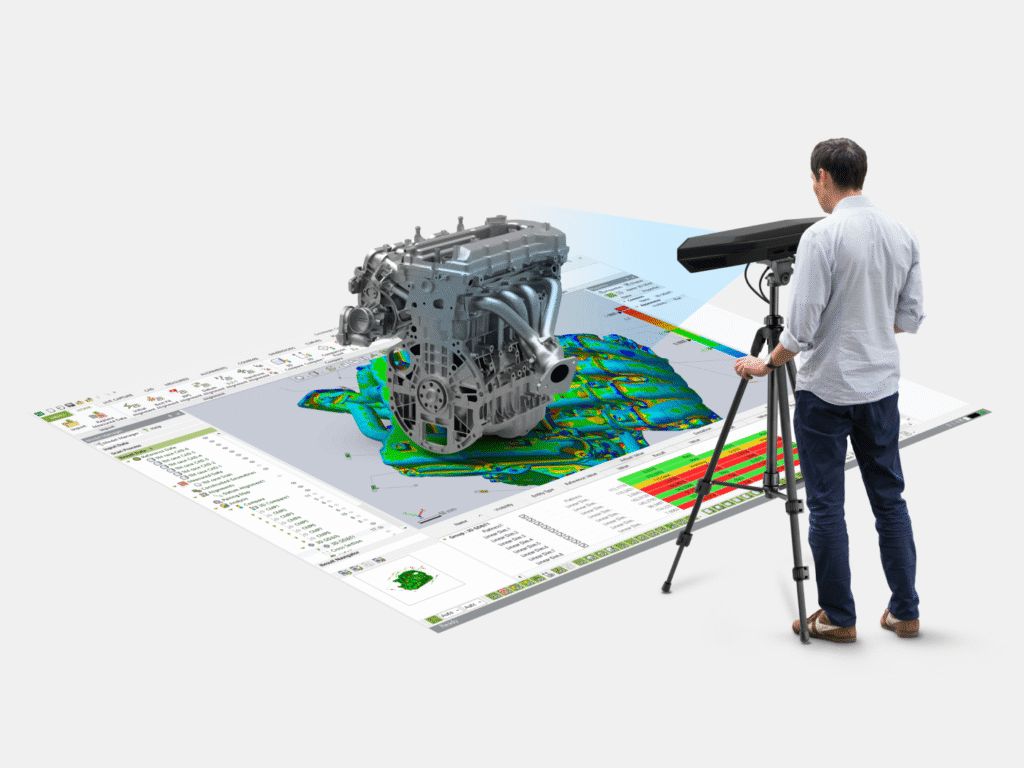
Scan to Mesh: From 3D laser scan data, we create clean, detailed 3D mesh models in a range of 3D mesh formats—ideal for visualization, reverse engineering, and digital archiving.
Scan to CAD: Using 3D laser scan data, we reverse engineer accurate as-built 3D CAD models—capturing complex geometry for redesigns, part replication, tooling, and component fit-up.
Scan to BIM: As-built BIM models are developed from 3D laser scan data, providing a true-to-field 3D model of current conditions for engineering, coordination, and construction.
Scan to Plant: Detailed plant design models and piping isometric drawings are produced from 3D laser scan data to support retrofit work, layout validation, and engineering deliverables.
Using 3D laser scanning, we generate accurate tank inspection and calibration reports for aboveground and underground storage tanks, supporting compliance, verification, and documentation.
For fast, high-accuracy volume measurements, we perform volumetric surveys with 3D laser scanning—ideal for storage tanks, ship ballast & fuel tanks, and material stockpiles.
Clear as-built 2D CAD documentation is created to match your standards—including engineering, architectural, and inspection drawings tailored to your project requirements.
By comparing design models to point clouds (or point clouds to each other), we deliver clash detection and deviation checks that reduce rework and confirm field conditions.
To quantify deformation and wear, we create high-resolution 3D color maps using 3D laser scanning and/or CMM measurements—making changes easy to visualize and report.
Utilizing 3D laser scanning, we generate accurate 2D & 3D topographic models. Additionally, with GNSS RTK rovers, we georeference your project data to real-world coordinates.
Ground penetrating radar (GPR) provides underground mapping in both 2D and 3D, helping identify subsurface features and utilities with clear, usable results.
With 3D laser scanning and TrueProp Software, we deliver fast, accurate propeller inspections in accordance with ISO 484 tolerance standards—supporting repairs and verification.
By leveraging 3D laser scanning, real-world objects and environments become high-quality digital 3D models—ideal for VR, AR, simulation, visualization, and 3D digital content creation.
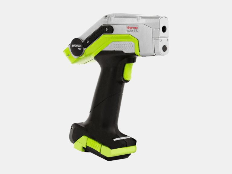
We use handheld LIBS and XRF analyzers to accurately identify materials, including carbon content for steel grade identification, and ultrasonic thickness gauges to precisely measure thickness.
Authorised Hexagon Distributor
Shop Hexagon Equipment
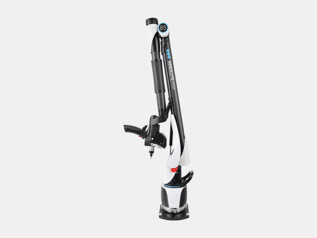
Portable Measuring Arms
Portable probing & 3D laser scanning for small-to-medium sized parts.
Laser Tracker Systems
Portable probing & 3D laser scanning for medium-to-ultra large sized parts.
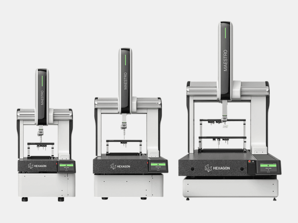
Coordinate Measuring Machines (CMMs)
Fixed ultra-high accuracy probing & 3D scanning for small-to-large sized parts.
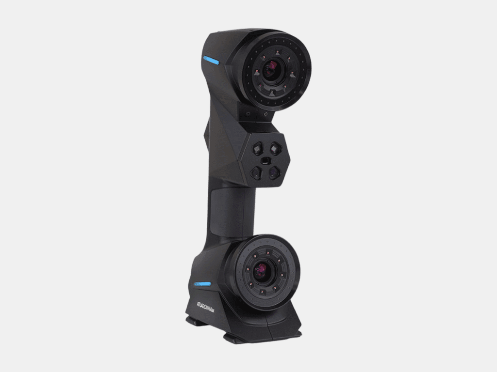
Handheld 3D Laser Scanners
Portable and flexible 3D laser scanning for small-to-medium sized parts.
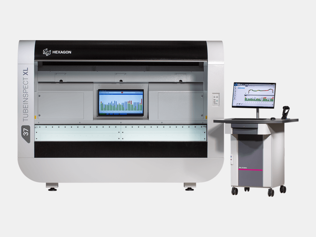
TubeInspect
All-in-one system for comprehensive tube and wire inspection.
Metrology Software
Comprehensive suite of metrology software including for reverse engineering, inspection, and design.
As-Built Modeling
Scan to CAD - From Accurate Point Cloud to Precise 3D CAD Models
OURCLIENTS
Trusted by leading companies across a diverse range of industries, including petrochemical, defense, mining, and manufacturing, we bring precision and reliability to every project.
OUR CLIENTS
We have partnered with clients across a diverse range of industries including petrochemical, defense, mining, manufacturing, and civil engineering.
Industry Leading
Our Equipment Features Best-In-Class Hardware & Software
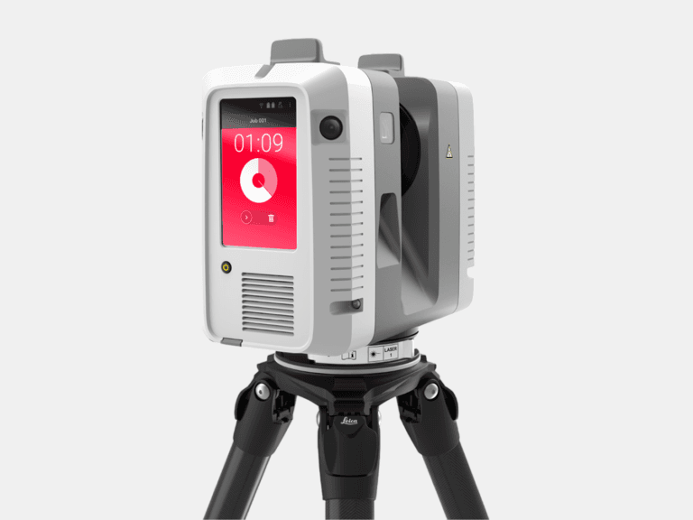
TERRESTRIAL 3D LASER SCANNER
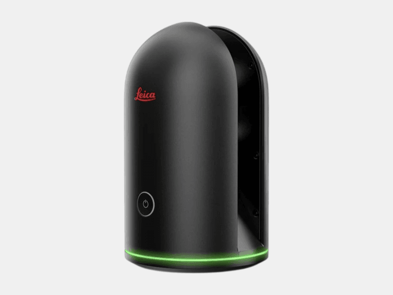
TERRESTRIAL 3D LASER SCANNER
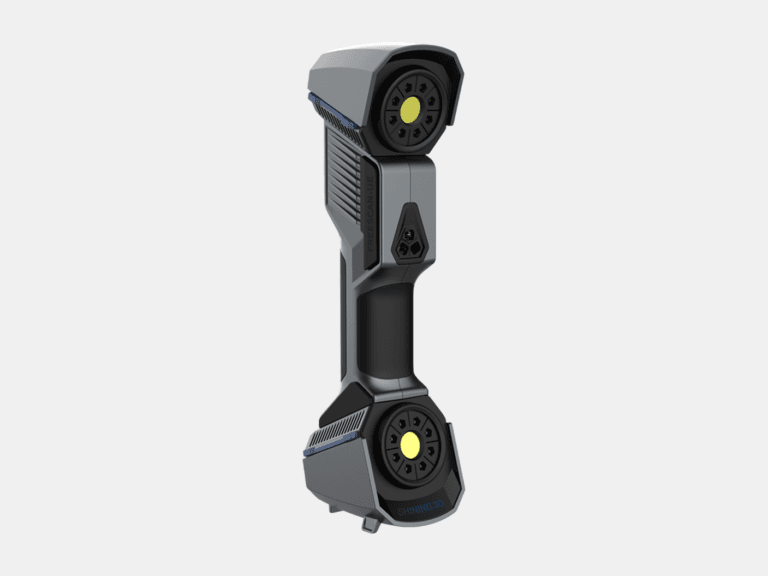
HANDHELD 3D LASER SCANNER
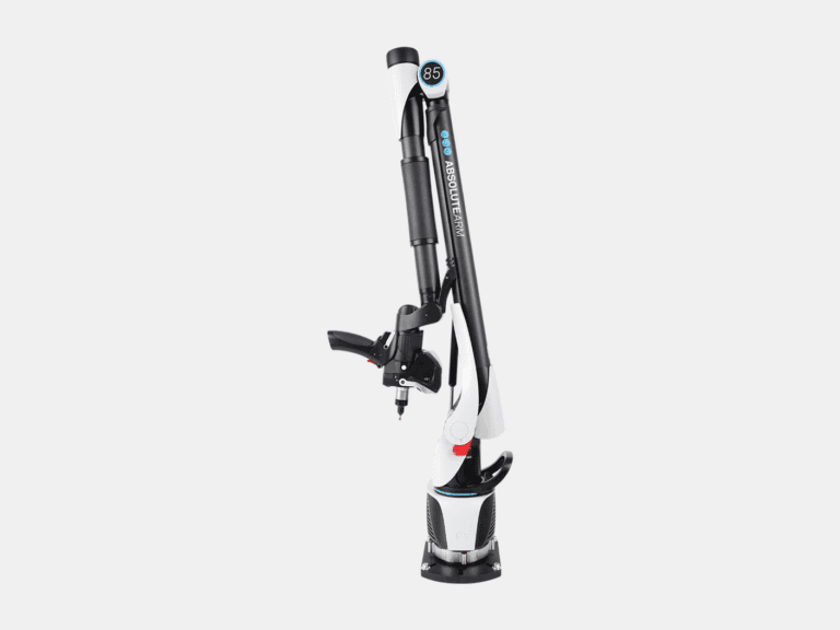
MEASURING ARM CMM
LASER TRACKER CMM
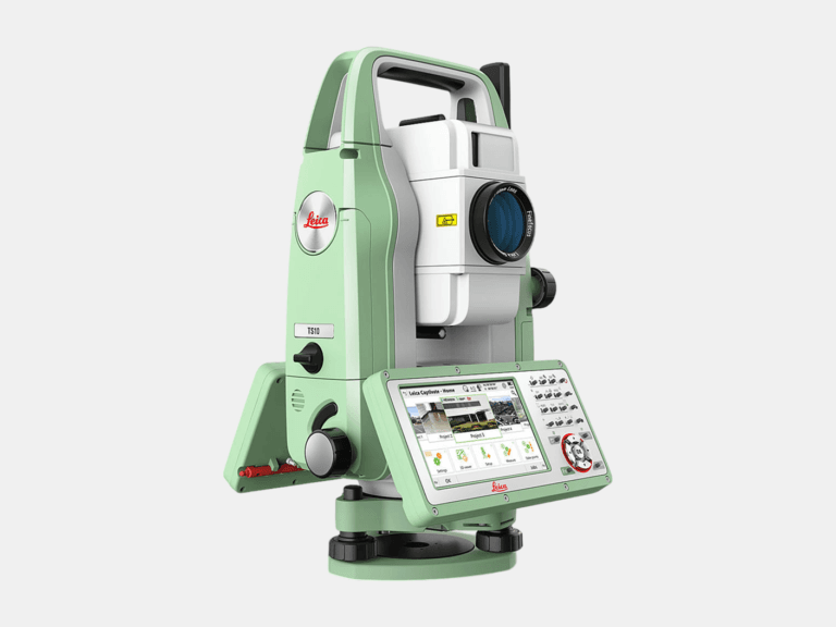
TOTAL STATION
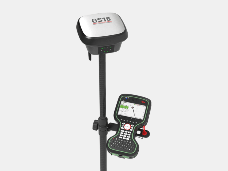
RTK GNSS ROVER
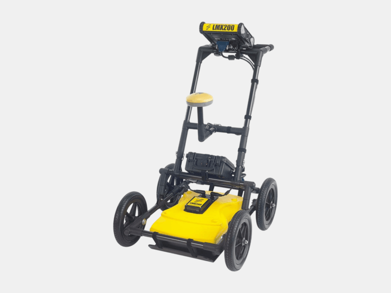
GROUND PENETRATING RADAR (GPR)
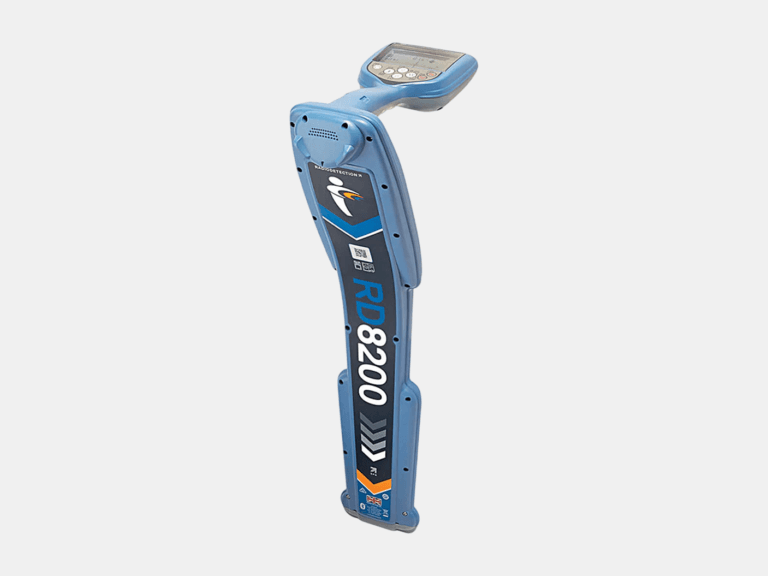
CABLE & PIPE LOCATOR
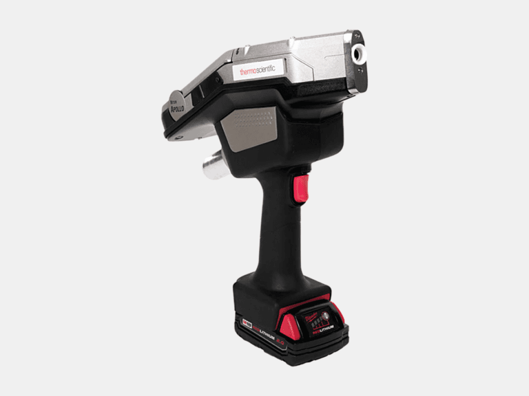
HANDHELD LIBS ANALYZER
HANDHELD XRF ANALYZER
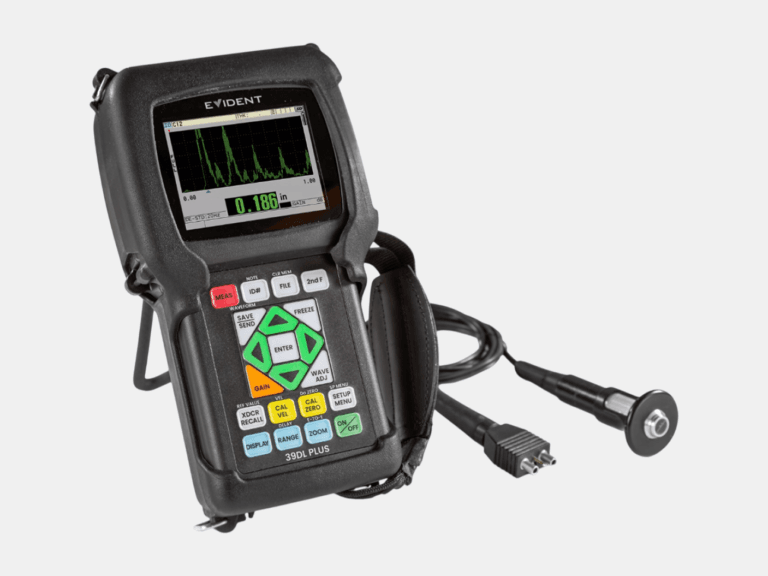
ULTRASONIC THICKNESS GAUGE
Exceptionally Accurate
Learn More About
Unrivaled Efficiency
What is Terrestrial 3D Laser Scanning
Terrestrial 3D laser scanning is an advanced reality-capture method for surveying medium to large assets with speed and accuracy. A tripod-mounted 3D laser scanner captures millions to billions of accurate 3D points—each with X, Y, and Z coordinates—to form a highly detailed point cloud of the environment. This point cloud becomes a reliable foundation for accurate as-built 2D drawings and 3D CAD models, inspection and analysis, visualization, and high-fidelity digital twins.
01
Accuracy
Millimeter accuracy for reliable measurements of medium to large assets.
02
Speed & Coverage
Capture millions of points per second for fast, comprehensive documentation.
03
Cost Savings
Reduce rework, change orders, and repeat site visits with complete, data-rich capture.
04
Safety
Capture from up to 130 m away, keeping personnel clear of hazards.
Unmatched Flexibility
What is Handheld 3D Laser Scanning
Handheld 3D laser scanning is a portable, high-detail measurement method that uses a high-accuracy 3D laser scanner to capture the exact shape of small to medium sized objects. By moving the 3D laser scanner around the part, it records dense 3D data and generates an accurate digital model for inspection and reverse engineering. With accuracy of up to 0.02 mm, handheld scanning is ideal for complex geometry, tight spaces, and components that require fine detail.
01
Accuracy
Up to 0.02 mm accuracy for accurate measurement of small to medium objects.
02
High Detail
Captures fine features and complex geometry for inspection and reverse engineering.
03
Speed
Fast capture with minimal setup—ideal for rapid inspection and short turnaround projects.
04
Flexibility
3D Scan in tight spaces and on-site conditions where tripod setups are impossible or slow.
Unparalleled Accuracy
What is Laser Tracker Measurement
Laser tracker measurement is a metrology-grade solution for high-accuracy probing, alignment, and dimensional inspection—ranging from small parts to large assemblies. A laser tracker CMM measures 3D coordinates in real time by tracking a reflector or probe, making it ideal for critical tolerance checks, installation alignment, tooling verification, and quality control. With probing accuracy of up to 0.015 mm, it delivers confidence for the most demanding measurement tasks.
01
Accuracy
Probing accuracy up to 0.015 mm for critical inspection of small to large objects.
02
Large-Scale Capability
Measure small to large objects and assemblies while maintaining high accuracy.
03
Real-Time Alignment
Instant feedback for faster alignment, assembly guidance, and corrective adjustments.
04
Traceable QA/QC
Clear measurement results and reporting to support quality documentation and compliance.