
OUR EQUIPMENT
-

LEICA RTC360
LEICA TERRESTRIAL 3D LASER SCANNER
With a range of 0.5-130 m and a 3D accuracy of 1.9 mm, this terrestrial 3D laser scanner is used to scan larger projects with the greatest precision. -

FARO FOCUS S 150
FARO TERRESTRIAL 3D LASER SCANNER
With a range of 0.6-150 m and a 3D accuracy of 2 mm, this terrestrial 3D laser scanner is used to scan larger projects with the highest level of accuracy. -

LEICA BLK360
LEICA TERRESTRIAL 3D LASER SCANNER
With a range of 0.6-60 m and a 3D accuracy of 4 mm, this terrestrial 3D laser scanner is used to scan smaller projects where space is constrained. -

SHINING FREESCAN UE PRO
SHINING METROLOGY-GRADE HANDHELD 3D LASER SCANNER
With a 3D accuracy of 0.02 mm, this metrology-grade handheld 3D laser scanner is used to scan small to medium-sized objects with even greater accuracy. -

FARO VANTAGE S6 MAX
FARO LASER TRACKER CMM
With a range of 0-80 m and a 3D accuracy of 0.016 mm + 0.0008 mm/m, this laser tracker CMM is used to measure the dimensions of larger objects, such as aligning heavy machinery, with the greatest level of accuracy. -

FARO QUANTUM MAX
FARO MEASURING ARM CMM
With a 3D accuracy of 0.024 mm for the contact probe and 0.030 mm for the laser line probe, this measuring arm CMM is used to measure and 3D laser scan small to medium-sized objects with the highest precision. -

LEICA FLEXLINE TS10 1" R1000
LEICA TOTAL STATION
With a range of 0.9–3500 m (accuracy of 1 mm) and an angular accuracy of 1 second, this total station is used to establish control points for large terrestrial 3D laser scanning projects. Using a total station allows us to create large registered point clouds with the greatest accuracy possible. -

LEICA GS18 T GNSS RTK ROVER
LEICA RTK GNSS
GNSS is used to georeference point clouds, BIM models, and other 2D and 3D models to a desired coordinate system. Using RTK, the Leica GS18 T GNSS has a 3D accuracy of 8 mm and employs tilt compensation, allowing for efficient and accurate data collection. -

RADIODETECTION LMX200 GPR
RADIODETECTION GPR
Ground-penetrating radar (GPR) uses radar pulses to image underground elements. It is a nondestructive testing (NDT) method of surveying subsurfaces to locate and investigate underground utilities such as cables and piping. -

SKYRAY EXPLORER HANDHELD XRF
SKYRAY HANDHELD XRF ANALYZER
XRF uses X-rays to accurately determine the percent elemental composition of materials. XRF is a nondestructive testing (NDT) method commonly used in reverse engineering to determine the percent composition of elements in metal alloys (such as iron, nickel, aluminum, chromium, etc). -
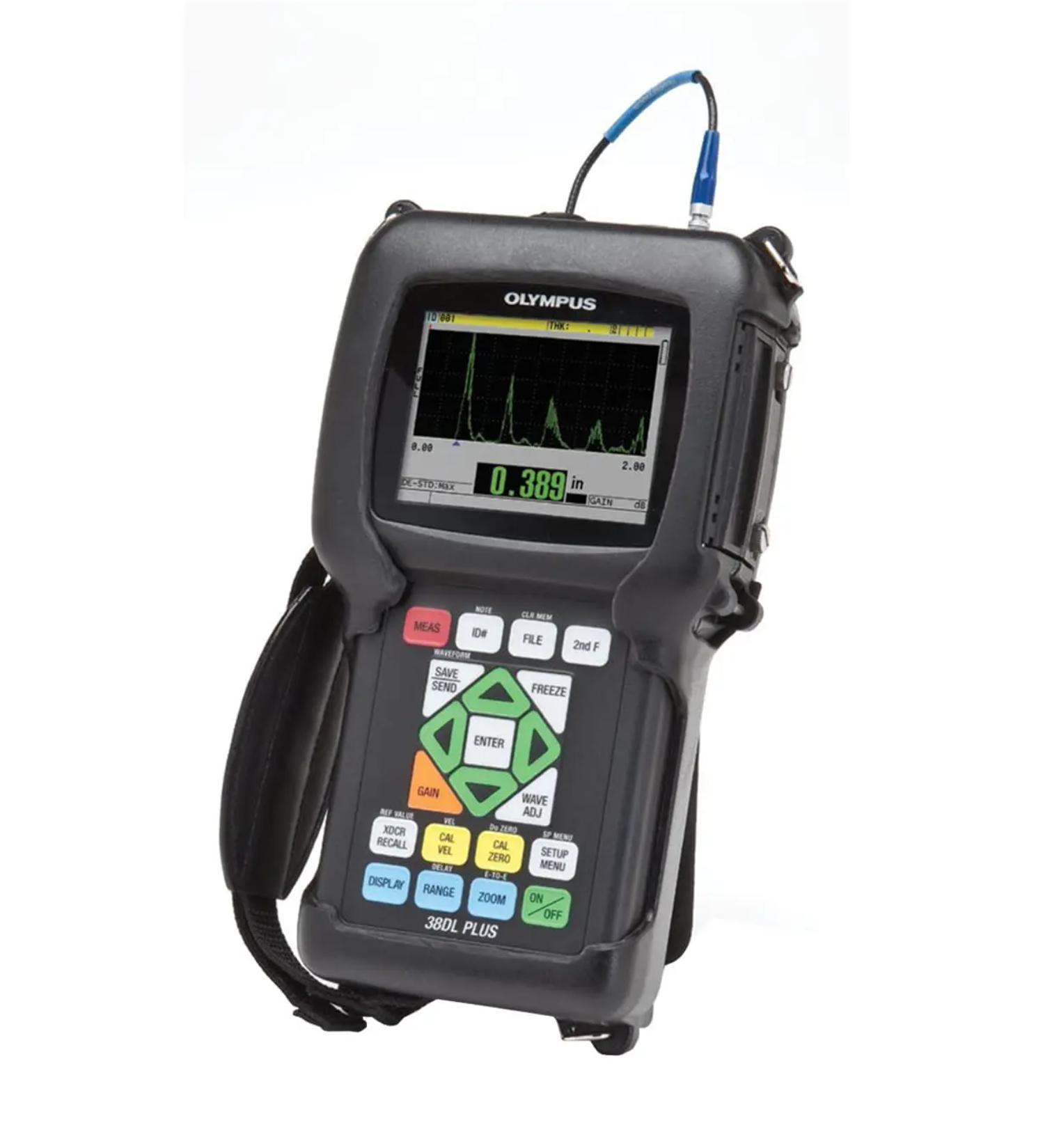
OLYMPUS 38DL PLUS
OLYMPUS ULTRASONIC THICKNESS GAUGE
With a thickness range of 0.08 mm to 635 mm and an accuracy of 0.001 mm, this ultrasonic thickness gauge is used to accurately and non-destructively measure thickness up to 4 layers for applications such as reverse engineering. -

SPHERE TARGETS
SPHERE TARGETS
We employ numerous sphere targets in a variety of sizes, including 155 mm, 200 mm, 250 mm, and 380 mm, as control points in terrestrial 3D laser scanning. Sphere targets are used as control points to more accurately register individual point clouds, especially in outdoor conditions. They are also used as reference points when georeferencing a point cloud.