CIVIL ENGINEERING
& ARCHITECTURE

CIVIL ENGINEERING & ARCHITECTURE
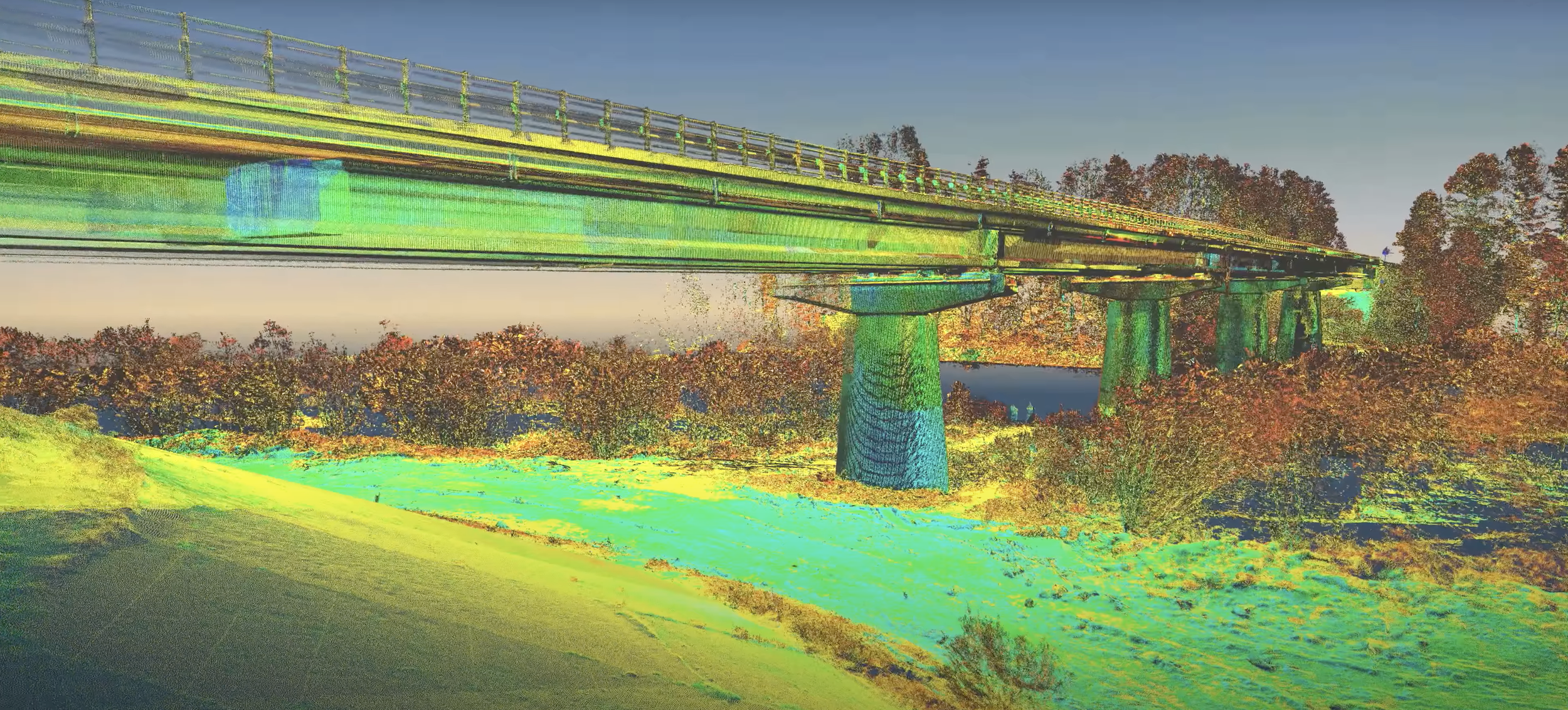
Compared to traditional surveying methods, 3D laser scanning is significantly faster, more accurate, and, most importantly, allows for the creation of detailed as-built 3D models of structures and buildings. By utilizing 3D laser scanning, we can produce precise as-built BIM models, 2D and 3D topographic models, and 2D CAD technical documentation, including architectural drawings, floor plans, section views, and elevation views.
Tailored to the specific needs of each project, we also deliver registered point clouds, 3D mesh models, 3D CAD models, and plant design models. In addition, we offer services such as volume surveys, construction verification, ground-penetrating radar (GPR) surveying, and georeferencing.
By comparing 3D scan data to design models or previously conducted 3D scans, we can monitor and perform deformation analysis and construction verification, allowing us to identify areas of concern. This capability plays a vital role in maintaining and advancing civil and architectural developments, ensuring the highest standards of precision and safety.
AS-BUILT SERVICES
Registered Point Clouds
3D Mesh Models (Scan to Mesh)
2D & 3D CAD Models (Scan to CAD)
BIM Models (Scan to BIM) & Plant Design Models (Scan to Plant)
Machinery Alignment & Inspection
Storage Tank Inspection & Calibration
Volume Surveys
Construction Verification
Deformation & Wear Analysis
Topographic Mapping
GPR (Underground Mapping)
Georeferencing
VR/AR & 3D Digital Content
XRF & Thickness Analysis
APPLICATIONS
Digital Twin
Building
Bridges & Roads
Power Lines
Ports
Train Stations
Hydro Installations
PRODUCTS
-
![REGISTERED POINT CLOUDS]()
REGISTERED POINT CLOUDS
Registered and cleaned, colored or black & white point clouds—ready for your workflow.
-
![3D MESH MODELS]()
3D MESH MODELS
High-fidelity as-built 3D mesh models in multiple file formats.
-
![3D CAD MODELS]()
3D CAD MODELS
Accurate as-built 3D CAD models for engineering applications.
-
![BIM MODELS]()
BIM MODELS
As-built BIM models for architecture, engineering, and construction.
-
![PLANT DESIGN MODELS]()
PLANT DESIGN MODELS
Optimized as-built plant design models for seamless integration.
-
![LASER TRACKER ALIGNMENT & INSPECTION]()
LASER TRACKER ALIGNMENT & INSPECTION
Alignment and inspection with laser trackers, CMMs, and 3D laser scanners.
-
![STORAGE TANK INSPECTION & CALIBRATION]()
STORAGE TANK INSPECTION & CALIBRATION
Detailed inspection and calibration reports using 3D laser scanning.
-
![VOLUME SURVEYS]()
VOLUME SURVEYS
Precise volumetric surveys for storage tanks, stockpiles, and equipment.
-
![2D CAD DOCUMENTATION]()
2D CAD DOCUMENTATION
Comprehensive as-built 2D CAD drawings for engineering and architecture.
-
![CONSTRUCTION VERIFICATION]()
CONSTRUCTION VERIFICATION
Clash detection and construction verification by comparing point clouds to design models.
-
![DEFORMATION & WEAR ANALYSIS]()
DEFORMATION & WEAR ANALYSIS
2D & 3D color map models and specialized inspections.
-
![TOPOGRAPHIC MAPPING & GEOREFERENCING]()
TOPOGRAPHIC MAPPING & GEOREFERENCING
Detailed 2D & 3D topographic and georeferenced data tailored to your project requirements.
-
![GPR (UNDERGROUND MAPPING)]()
GPR (UNDERGROUND MAPPING)
Subsurface mapping using ground-penetrating radar.
-
![VR/AR & 3D DIGITAL CONTENT]()
VR/AR & 3D DIGITAL CONTENT
Real-world objects converted into immersive 3D digital experiences.
-
![XRF & ULTRASONIC THICKNESS ANALYSIS]()
XRF & ULTRASONIC THICKNESS ANALYSIS
XRF material identification and ultrasonic thickness measurements.
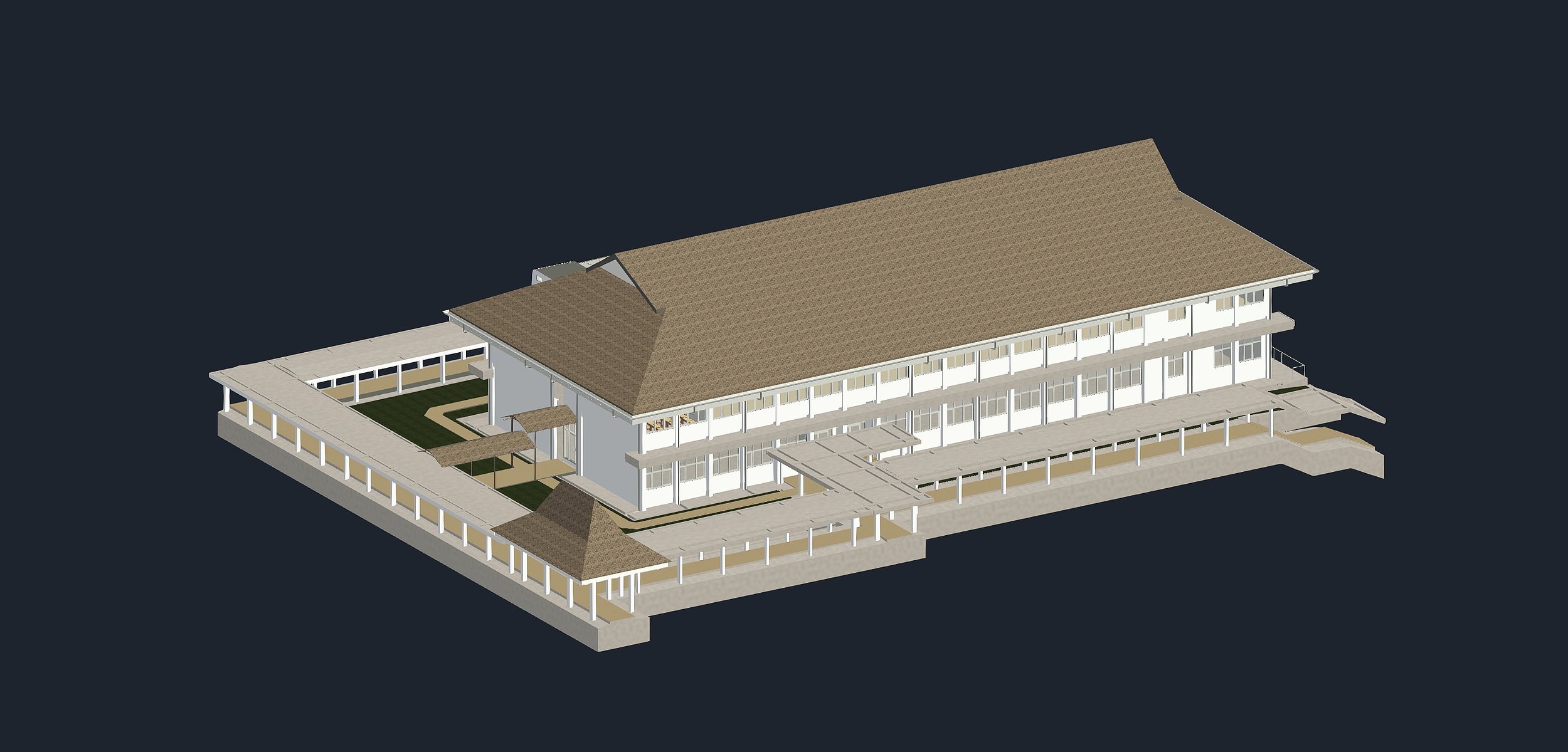
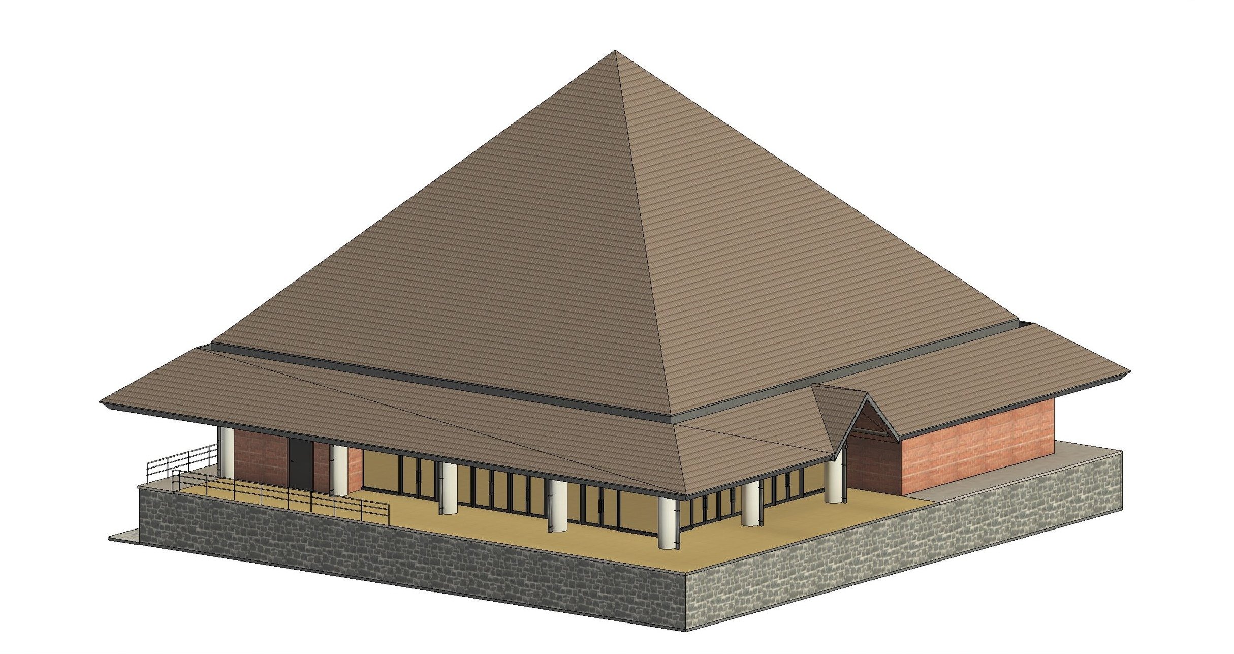
SCAN TO BIM
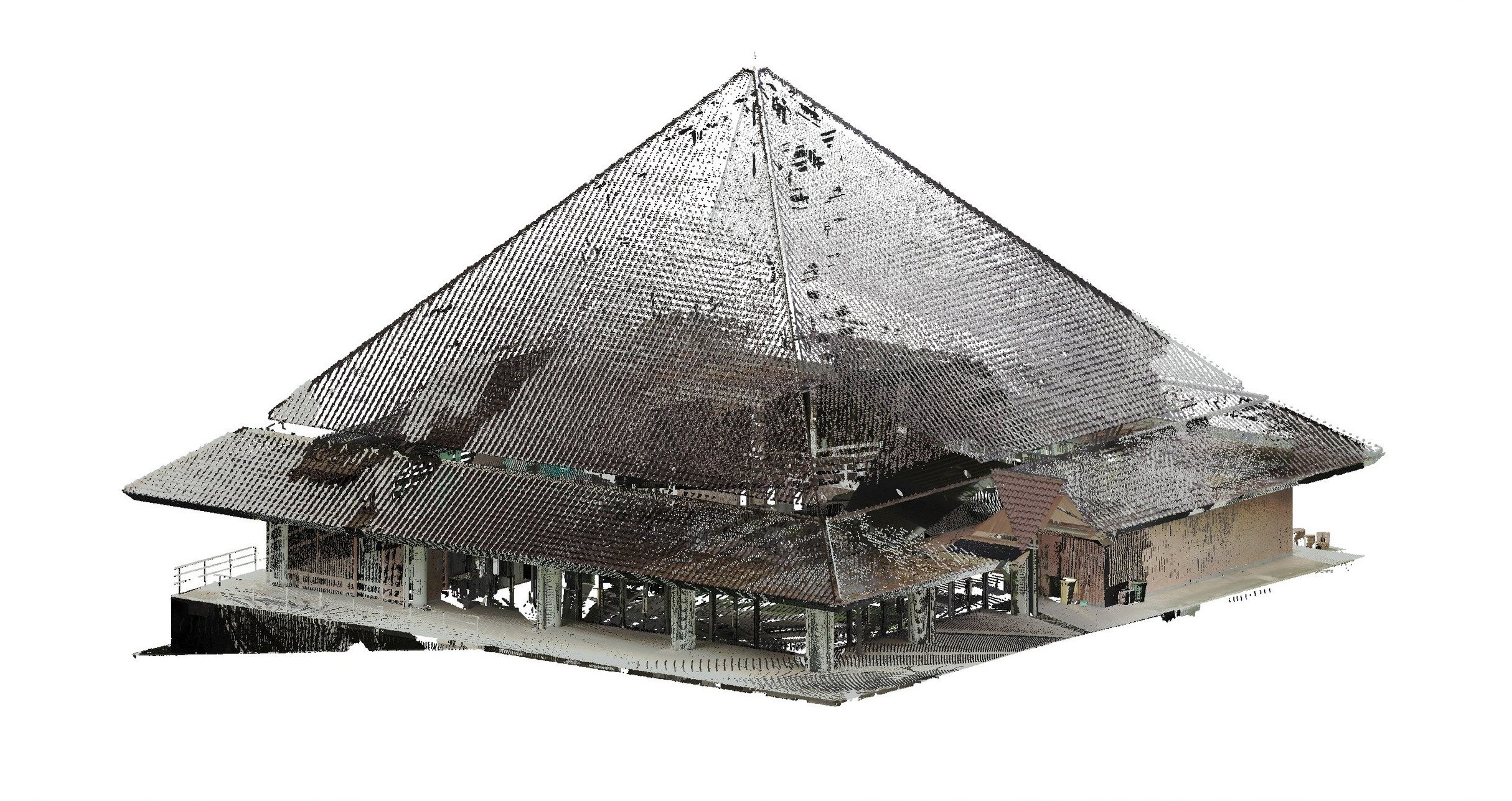
POINT CLOUD
*Point density of above point cloud was reduced by 99% in order to upload to web viewer. Actual point cloud is much more detailed.
BIM MODEL