REGISTERED
POINT CLOUDS
REGISTERED POINT CLOUDS
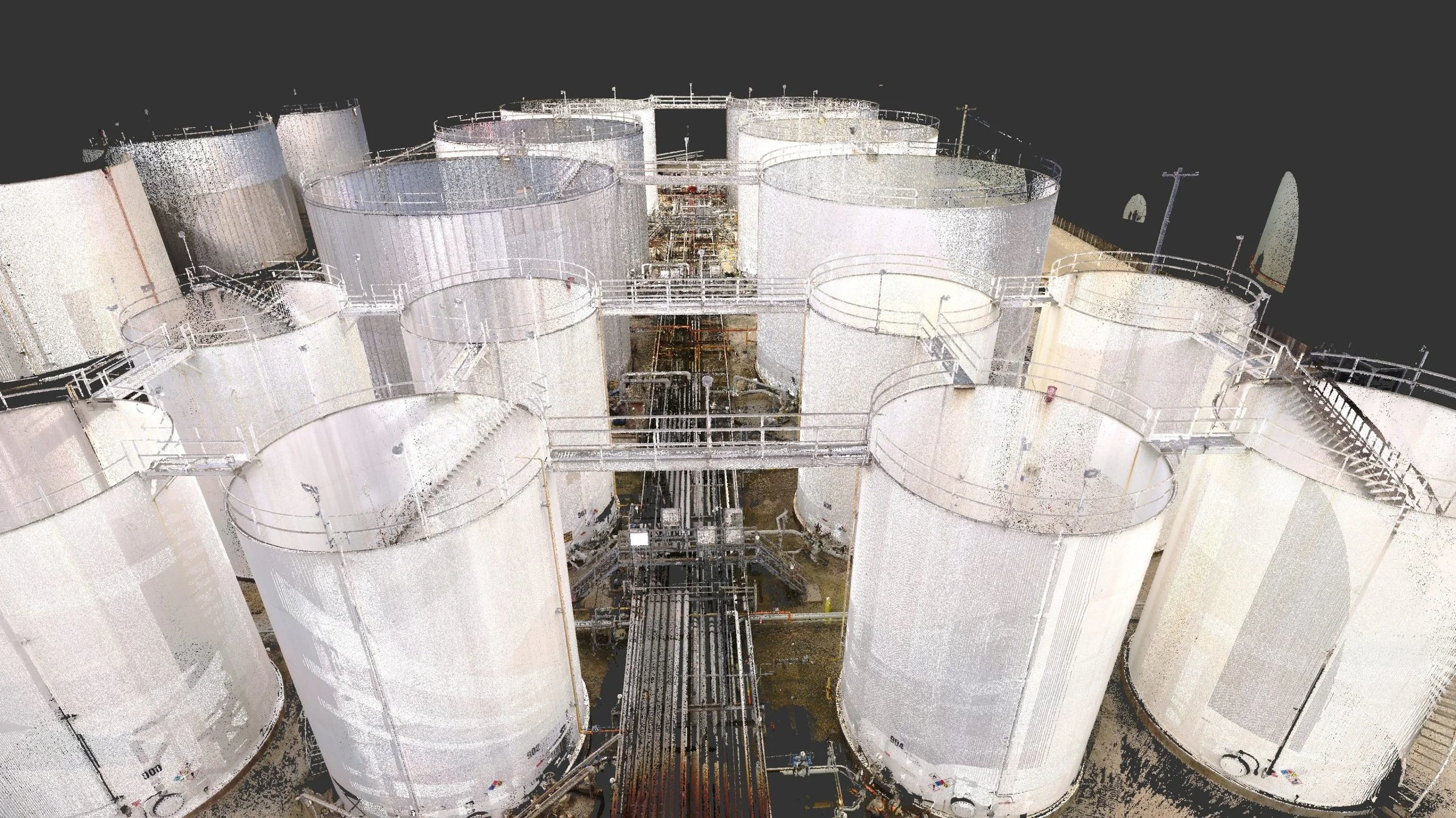
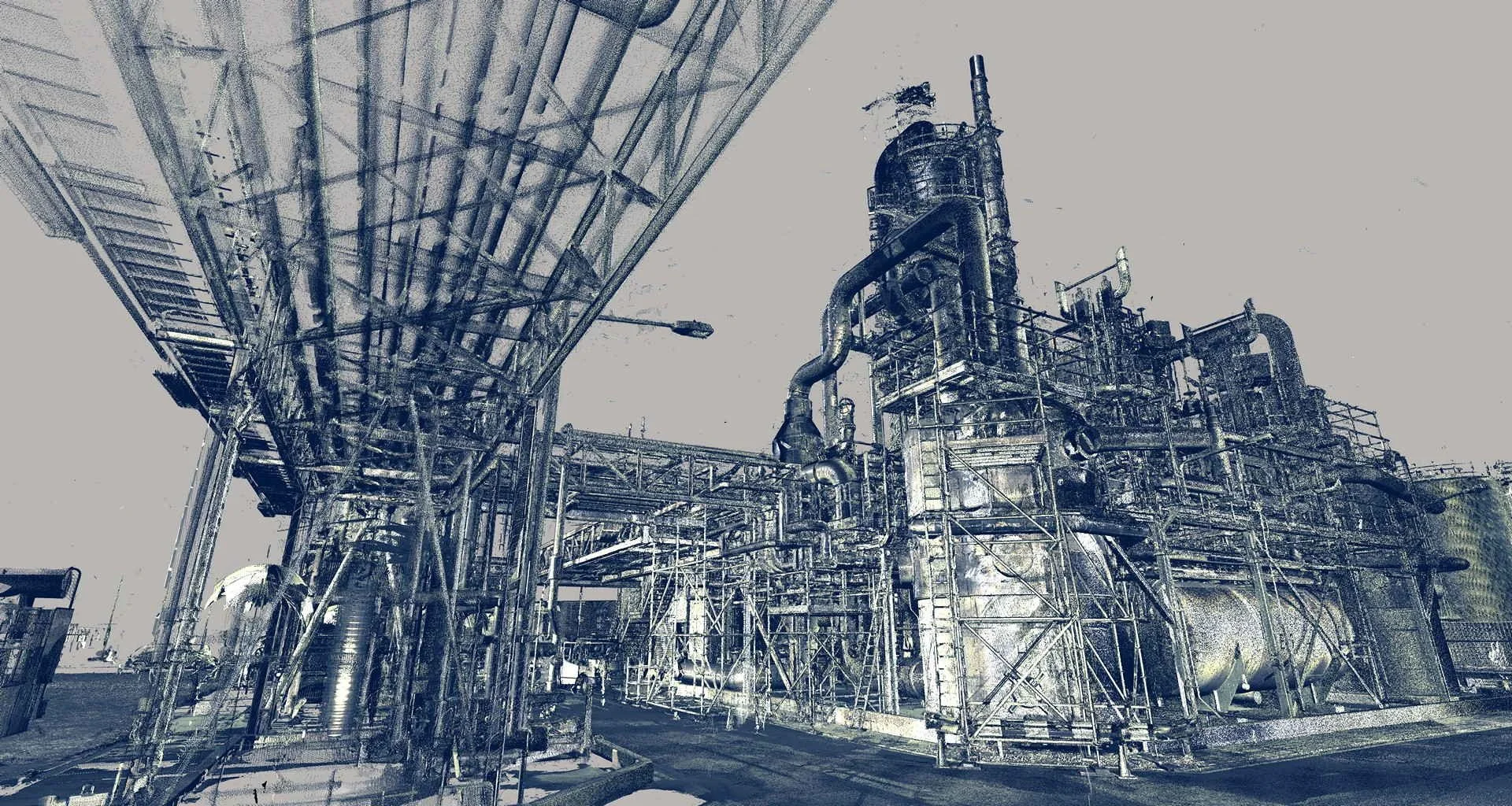
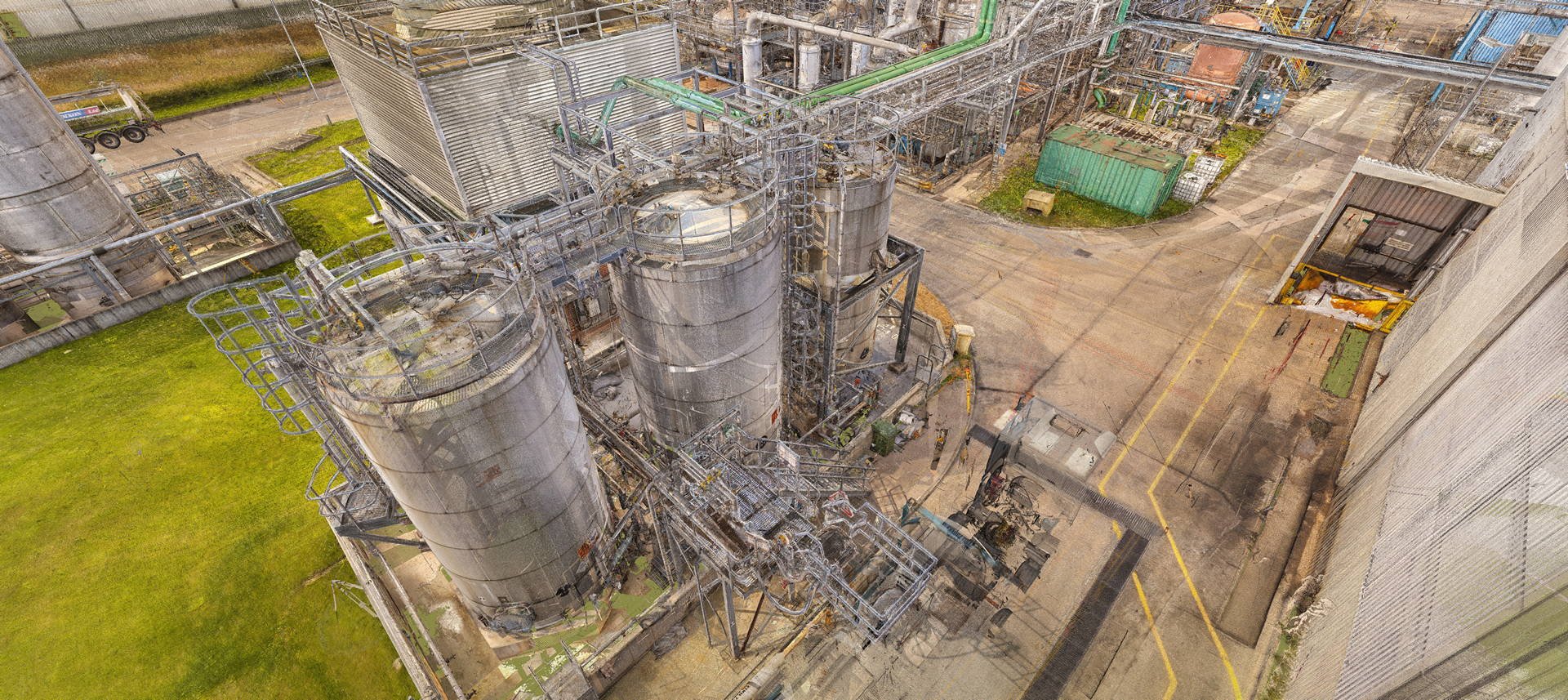
3D laser scanning is an efficient and accurate method of collecting spatial data that surpasses what traditional survey techniques can achieve. A 3D laser scanner can capture up to two million individual colored points per second, with each data point containing its own X, Y, and Z coordinate. These millions to billions of individual points form a data format known as a point cloud, which is the least processed type of data produced by 3D laser scanning.
From a point cloud, it is possible to create 3D mesh models, 2D and 3D CAD models, BIM models, plant design models, and models for VR/AR and other 3D digital content. Additionally, a point cloud can be used for processes such as machinery alignment and inspection, storage tank inspection and calibration, volume surveys, construction verification, deformation and wear analysis, and the creation of topographic information. However, as many of our clients prefer to generate their own products from point clouds, we can provide cleaned, colored, or black-and-white registered point clouds in any point cloud file format, particularly for digital twin applications.
For larger terrestrial 3D laser scanning projects, we employ a total station to establish survey control points using checkered and sphere targets, ensuring the greatest possible accuracy. By using a total station, we can register large scan datasets more accurately, thanks to the total station’s significantly higher angular and range accuracy compared to that of a terrestrial 3D laser scanner. In turn, this approach helps correct any measurement drift that may occur in large-scale laser scanning projects and allows for more thorough quality control analyses.
EQUIPMENT USED
Terrestrial 3D Laser Scanner: Leica RTC360 (3D Accuracy: 1.9 mm)
Terrestrial 3D Laser scanner: Faro Focus S 150 (3D Accuracy: 2 mm)
Terrestrial 3D Laser Scanner: Leica BLK360 (3D Accuracy: 4 mm)
Metrology-Grade Handheld 3D Scanner: Shining FreeScan UE Pro (3D Accuracy: 0.02 mm)
Measuring Arm CMM: Faro Quantum Max (3D Accuracy: 0.030 mm)
Total Station: Leica FlexLine TS10 1” R1000 (Accuracy: 1 mm, Angular Accuracy: 1 s)
RTK GNSS: Leica GS18 T GNSS RTK Rover (Accuracy: 8 mm)
Sphere Targets
APPLICATIONS
Digital Twin Models
3D Mesh Models (Scan to Mesh)
2D & 3D CAD Models (Scan to CAD)
BIM Models (Scan to BIM) & Plant Design Models (Scan to Plant)
Machinery Alignment & Inspection
Storage Tank Inspection & Calibration
Volume Surveys
Construction Verification
Deformation & Wear Analysis
Topographic Mapping
Georeferencing
VR/AR & 3D Digital Content
APPLICATIONS
-
![REVERSE ENGINEERING]()
REVERSE ENGINEERING
Streamline the creation and inspection of specialized parts and equipment through reverse engineering.
-
![INDUSTRY & ENERGY]()
INDUSTRY & ENERGY
Elevate industry operations with 3D laser scanning, which rapidly collects spatial 3D data and minimizes on-site disruptions.
-
![MINING & TUNNELING]()
MINING & TUNNELING
Optimize safety and efficiency in mines and tunnels with 3D laser scanning.
-
![CIVIL ENGINEERING & ARCHITECTURE]()
CIVIL ENGINEERING & ARCHITECTURE
Advance civil and architectural projects with faster, more accurate surveying through 3D laser scanning.
-
![MARINE & OFFSHORE]()
MARINE & OFFSHORE
Transform offshore and maritime operations with advanced 3D laser scanning solutions.