MINING
& TUNNELING
MINING & TUNNELING
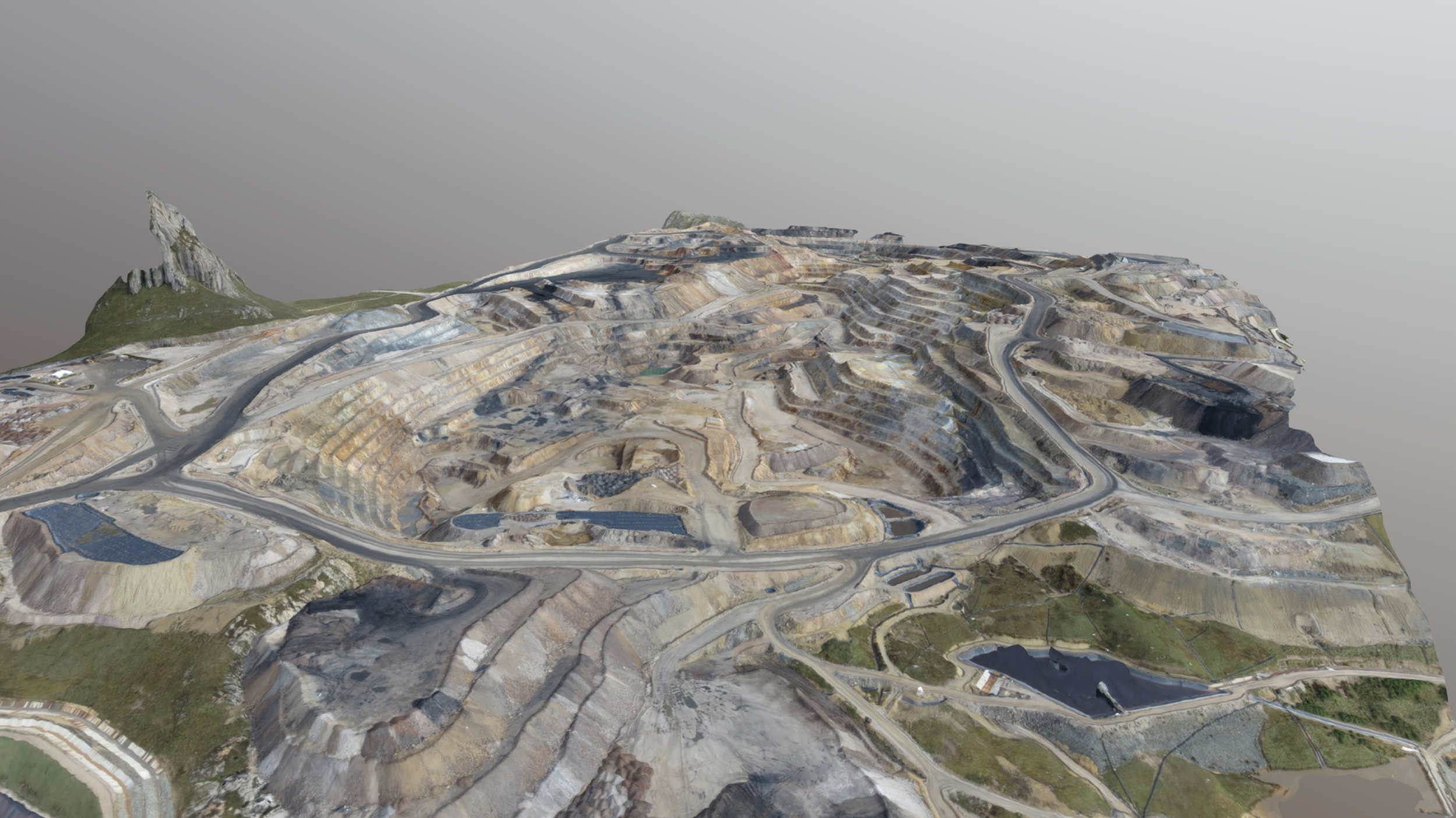
For mines and tunnels, mapping and monitoring are essential to ensuring safety and maintaining smooth operations. 3D laser scanning enables precise and efficient 3D measurement and surveying of the condition of mines and tunnels, achieving a level of accuracy capable of detecting signs of structural failure, such as deformation. 3D laser scanning not only enhances safety but also reduces the risk of costly disruptions.
By performing periodic 3D laser scans and comparing the data over time, we can monitor and identify areas of concern, such as potential deformation or instability. These areas can then be analyzed using deformation analysis to assess structural integrity. This approach helps to improve safety, extend operational longevity, and mitigate unexpected setbacks.
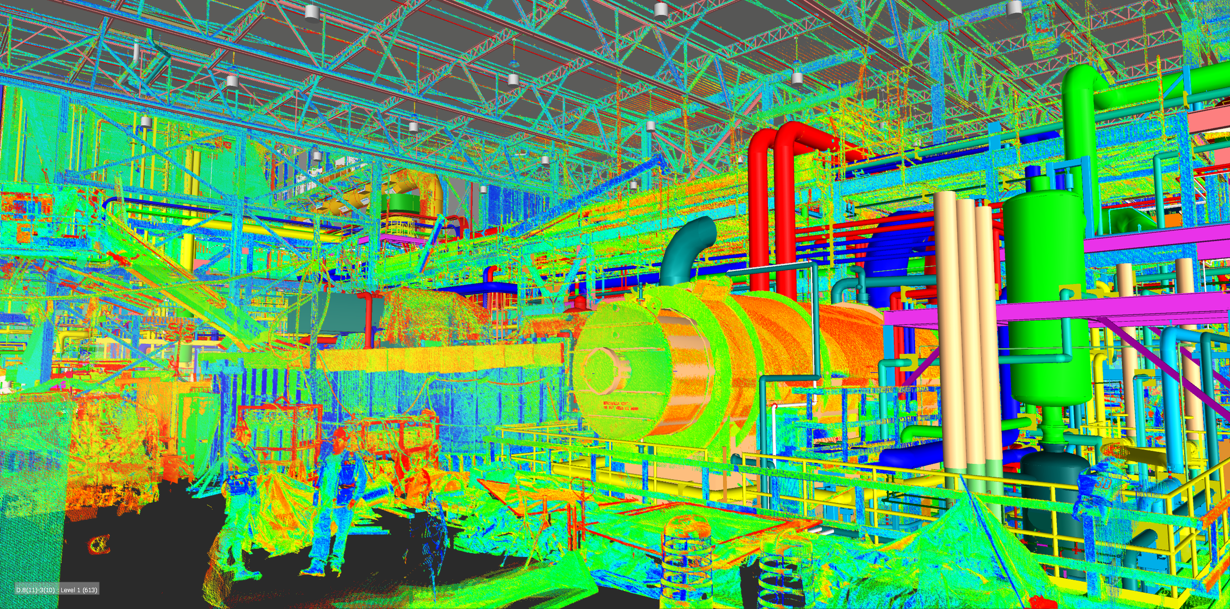
3D laser scan data can be customized to meet the specific requirements of clients in terms of format and application. Deliverables can include as-built 3D models not limited to registered point clouds, 3D mesh models, 3D CAD models, BIM models, and plant design models.
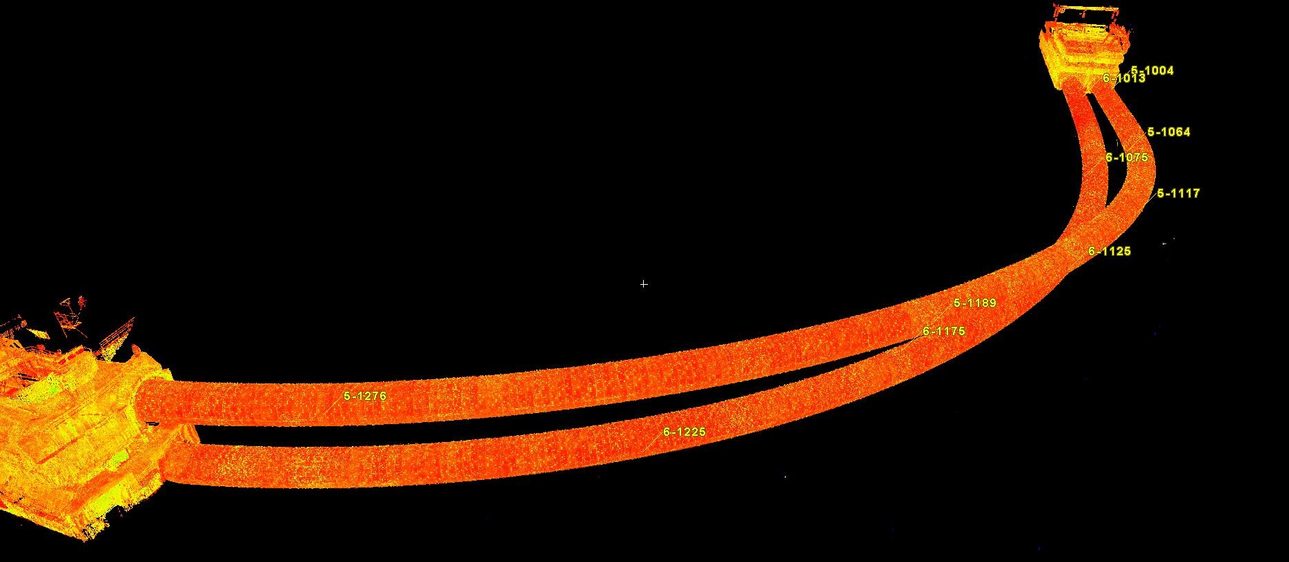
Additionally, using 3D laser scan data, we provide a range of services, including machinery alignment and inspection, storage tank inspection and calibration, volume surveys, creation of 2D CAD technical documentation, deformation and wear analysis, generation of topographic and underground GPR (ground penetrating radar) information, and georeferencing services. These capabilities allow us to deliver comprehensive solutions tailored to the complex needs of mining and tunneling operations.
AS-BUILT SERVICES
Registered Point Clouds
3D Mesh Models (Scan to Mesh)
2D & 3D CAD Models (Scan to CAD)
BIM Models (Scan to BIM) & Plant Design Models (Scan to Plant)
Machinery Alignment & Inspection
Storage Tank Inspection & Calibration
Volume Surveys
Construction Verification
Deformation & Wear Analysis
Topographic Mapping
GPR (Underground Mapping)
Georeferencing
VR/AR & 3D Digital Content
XRF & Thickness Analysis
APPLICATIONS
Digital Twin
Underground Mining
Open-Pit Mining
Tunneling
Stockpile & Land Survey
PRODUCTS
-
![REGISTERED POINT CLOUDS]()
REGISTERED POINT CLOUDS
Registered and cleaned, colored or black & white point clouds—ready for your workflow.
-
![3D MESH MODELS]()
3D MESH MODELS
High-fidelity as-built 3D mesh models in multiple file formats.
-
![3D CAD MODELS]()
3D CAD MODELS
Accurate as-built 3D CAD models for engineering applications.
-
![BIM MODELS]()
BIM MODELS
As-built BIM models for architecture, engineering, and construction.
-
![PLANT DESIGN MODELS]()
PLANT DESIGN MODELS
Optimized as-built plant design models for seamless integration.
-
![LASER TRACKER ALIGNMENT & INSPECTION]()
LASER TRACKER ALIGNMENT & INSPECTION
Alignment and inspection with laser trackers, CMMs, and 3D laser scanners.
-
![STORAGE TANK INSPECTION & CALIBRATION]()
STORAGE TANK INSPECTION & CALIBRATION
Detailed inspection and calibration reports using 3D laser scanning.
-
![VOLUME SURVEYS]()
VOLUME SURVEYS
Precise volumetric surveys for storage tanks, stockpiles, and equipment.
-
![2D CAD DOCUMENTATION]()
2D CAD DOCUMENTATION
Comprehensive as-built 2D CAD drawings for engineering and architecture.
-
![CONSTRUCTION VERIFICATION]()
CONSTRUCTION VERIFICATION
Clash detection and construction verification by comparing point clouds to design models.
-
![DEFORMATION & WEAR ANALYSIS]()
DEFORMATION & WEAR ANALYSIS
2D & 3D color map models and specialized inspections.
-
![TOPOGRAPHIC MAPPING & GEOREFERENCING]()
TOPOGRAPHIC MAPPING & GEOREFERENCING
Detailed 2D & 3D topographic and georeferenced data tailored to your project requirements.
-
![GPR (UNDERGROUND MAPPING)]()
GPR (UNDERGROUND MAPPING)
Subsurface mapping using ground-penetrating radar.
-
![VR/AR & 3D DIGITAL CONTENT]()
VR/AR & 3D DIGITAL CONTENT
Real-world objects converted into immersive 3D digital experiences.
-
![XRF & ULTRASONIC THICKNESS ANALYSIS]()
XRF & ULTRASONIC THICKNESS ANALYSIS
XRF material identification and ultrasonic thickness measurements.
SCAN TO CAD


POINT CLOUD
CAD MODEL