GPR (UNDERGROUND
MAPPING)

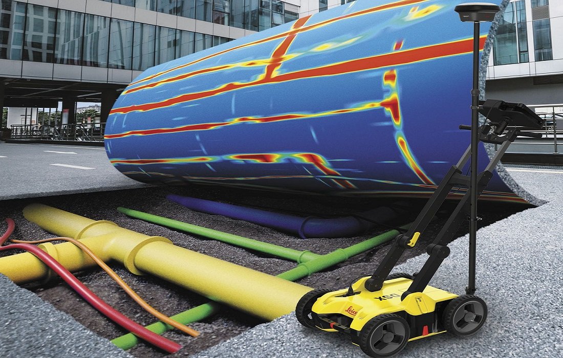

GPR (UNDERGROUND MAPPING)
Ground-penetrating radar (GPR) is a highly effective, non-intrusive, and non-destructive surveying method that uses radar pulses to detect and visualize subsurface objects. GPR underground mapping is commonly employed to locate underground utilities such as cables, pipelines, and other buried infrastructure. With its ability to penetrate various ground materials, GPR can accurately identify objects buried up to eight meters below the surface, making it an essential tool for construction and engineering projects.
When combined with GNSS data, GPR data can be converted into precise 2D survey maps that provide detailed information about the position and depth of underground utilities. These maps are invaluable for planning and executing projects involving excavation or construction near critical subsurface assets, helping to minimize risks and ensure accuracy.
Additionally, GPR data can be utilized in advanced design and modeling processes. By integrating GPR data into CAD software, comprehensive 2D and 3D models of subsurface infrastructure can be developed. These models can then be incorporated into BIM and plant design models, enabling a fully integrated view of both aboveground and underground elements. This approach enhances project planning, improves safety during excavation, and reduces the likelihood of accidental damage to essential underground utilities.
EQUIPMENT USED
Total Station: Leica FlexLine TS10 1” R1000 (Accuracy: 1 mm, Angular Accuracy: 1 s)
RTK GNSS: Leica GS18 T GNSS RTK Rover (Accuracy: 8 mm)
GPR: Radiodetection LMX200
APPLICATIONS
Underground Mapping of Utilities and Services in Urban & Non-Urban Environments
BIM Models
Plant Design Models
Georeferencing of Underground Mapping
APPLICATIONS
-
![INDUSTRY & ENERGY]()
INDUSTRY & ENERGY
Elevate industry operations with 3D laser scanning, which rapidly collects spatial 3D data and minimizes on-site disruptions.
-
![MINING & TUNNELING]()
MINING & TUNNELING
Optimize safety and efficiency in mines and tunnels with 3D laser scanning.
-
![CIVIL ENGINEERING & ARCHITECTURE]()
CIVIL ENGINEERING & ARCHITECTURE
Advance civil and architectural projects with faster, more accurate surveying through 3D laser scanning.